The Israeli Defence Forces (IDF) announced in an X post on October 20 that they had "started to delineate the yellow line in the Gaza Strip”. Their intention? To create “tactical clarity on the ground”.
Images shared in the post show heavy machinery planting giant, bright yellow blocks of concrete, topped with yellow guide posts and flags, in the ruined landscape.
This delineation is part of the first phase of the peace plan proposed by US President Donald Trump and accepted by Israel and Hamas on October 9.
To display this content from X (Twitter), you must enable advertisement tracking and audience measurement.
Along with a ceasefire and the exchange of Palestinian prisoners for Israeli hostages, this phase also involves Israeli troops withdrawing to the east of this line, in an area covering about 53 percent of the enclave.
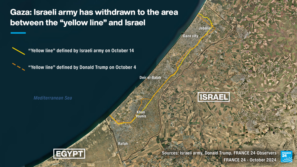
The line was roughly sketched out in a map shared by the White House X account in late September. Trump shared another map on October 4 in a post on his social media Truth Social.
To display this content from Truth Social, you must enable advertisement tracking and audience measurement.
After the peace accord was signed, COGAT – the Israeli defence ministry body tasked with overseeing civilian policy in the Palestinian territories – posted a different map of the forthcoming yellow line on Facebook. This line was different to the line shared by Trump.
"It is extremely dangerous to get close to Beit Hanoun, Beit Lahiya, Shujaiya and zones where troops have been deployed, in accordance with the yellow line on the map,” explained the post (in Hebrew) on October 14.
To display this content from Facebook, you must enable advertisement tracking and audience measurement.
A few days later, the IDF spokesperson shared the same map, calling on Gazans to stay west of the yellow line.
‘Indistinct boundary’
NGOs were quick to speak out about a lack of clarity about the location of the line. Israeli NGO Gisha, which works to protect the freedom of movement of Palestinians, published a statement on October 19. “In practice, the map does not indicate exactly where the line passes,” it read.
Between October 10 and 15, the Israeli army shot and killed 15 Palestinians near areas in close proximity to the remaining Israeli forces, according to the Office of the United Nations High Commissioner for Human Rights.
The Israeli army killed 11 Gazan civilians, including children, on October 17 when they were driving east of Gaza City, according to Hamas. The Israeli army said that they shot at a "suspicious vehicle" that got too close to the "yellow line”.
Concrete bases for yellow guide poles
Against this backdrop, Israeli Defence Minister Israel Katz announced on X on October 17 that the army had "started to mark the yellow line” in the hopes of “warning Hamas terrorists and Gaza residents that any violation or attempt to cross the line will be met with fire”.
To display this content from X (Twitter), you must enable advertisement tracking and audience measurement.
The army said in a tweet that they had begun installing concrete blocks topped with yellow guide poles every 200 metres along the yellow line.
Images shared by the army and geolocated by specialist accounts on X show that the blocks were installed in at least two locations: near Khan Younis in the south of the Gaza Strip and just south of Beit Lahiya, located in the north of the Strip.
In both cases, the images show that the markers were placed several hundred metres farther into the enclave than the line drawn by the Israeli army.
Experts interviewed by the BBC said that Israel was perhaps trying to establish a "buffer zone".
"It is a bit like no man's land that does not belong to anyone – and Israel tends to take that territory from the opponent's chunk not its own,” Dr Andreas Krieg, associate professor at King's College London, said in an interview with the BBC.
To display this content from X (Twitter), you must enable advertisement tracking and audience measurement.
‘Heightened exposure to live-fire incidents’
Shai Grunberg, the spokesperson for Gisha, says that the fact that this boundary remains “indistinct” is in keeping with Israeli practices:
“Throughout the war, Israel’s maps and ‘evacuation zones’ have been vague and inconsistent, leaving people unsure whether or not they were inside dangerous areas.
Even now, marking parts of the line does not ensure [everyone’s] safety. Many displaced residents are still trying to reach their homes or lands ‘behind the line’, often without clear indications on its whereabouts.
For people already living through repeated displacements, severe overcrowding and degraded basic services, the effect is a continuing fragmentation of civilian life with heightened exposure to live-fire incidents near an indistinct boundary.”
For Grunberg, it is important to remember that the army hasn’t been excused from legal obligations around the use of force just because the line has been demarcated:
“Under international law, [the army] must refrain from targeting civilians regardless of proximity to any line or warning. The army must always distinguish between civilians and combatants, use force only when strictly necessary and proportionate, and take constant precautions to protect civilians.
Official statements warning that any ‘violation’ of the line will be ‘met with fire’ do not justify harm to civilians and do not absolve Israel from its responsibility and legal obligations.”
The Israeli army did not respond to the questions that our team put to them.
‘This line means that civilians can’t pick up their lives’
While the ceasefire has brought relative calm to the Gaza Strip, this line still prevents hundreds of thousands of Palestinians from returning home.
Israel is still occupying the towns of Beit Lahiya, Beit Hanoun and Rafah, as well as certain neighbourhoods in Gaza City.
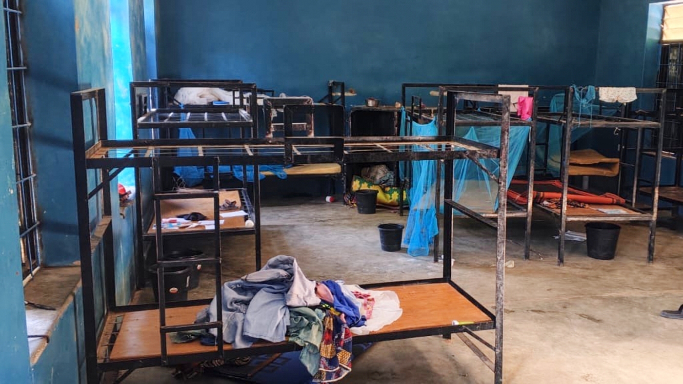
Our Observer Akram Abu Khoussa had to flee his farm, located in the north of the Gaza Strip, back in mid-March 2025. Even though the ceasefire has been declared, he can’t return home because it is on the other side of the "yellow line". Akram is currently living in a displaced persons camp in Nuseirat, in the middle of the Gaza Strip:
“When we found out about the yellow line and saw it in the maps published by the occupation, we understood that we were going to have to stay in the displaced people camps. It’s really frustrating not to be able to return home.
We hope that we can return home when the next step [of the peace plan] is in place. We will return there on the first day they withdraw. We don’t know when that will be. But this line means that civilians can’t go home or get back to work or to their lives. Everyone needs stability in order to live a happy life.”
Read moreGaza's agriculture ravaged by war
Some Gazans who live near the yellow line, like those in Khan Younis, have actually been displaced by the line. The Israeli army dropped pamphlets demanding that residents leave the area.
"For your security, you are asked to stay away from the yellow line ... Anyone who crosses the line is in danger,” reads a pamphlet that was dropped.
To display this content from Instagram, you must enable advertisement tracking and audience measurement.
‘Keeping farmers out of the eastern belt means prolonging what is already a food-insecurity crisis’
Shai Grunberg told our team that there are a large number of important sites to the east of the yellow line that remain inaccessible:
“This zone includes key humanitarian logistics and public-service assets, such as warehouses used by UN and other NGOs; water and sanitation infrastructure ... and solid-waste sites.
The area is also essential to humanitarian operations as they need access to all the crossings to the Strip. The prolonged closure of Zikim crossing in the north has already severely hindered aid to people there, even as limited aid enters via Kerem Shalom and Kissufim in the south.
Before the war, about 41 percent of Gaza’s land was used for agriculture, mostly along its northern and eastern edges, now beyond the “yellow line." Keeping farmers out of the eastern belt means prolonging what is already a food-insecurity crisis.”
The "yellow line” is supposed to be temporary. On September 29, the White House X account shared this map showing three lines indicating the successive waves of withdrawal that are part of the three-step plan proposed by Donald Trump.
To display this content from X (Twitter), you must enable advertisement tracking and audience measurement.
In the second phase, the Israeli army is expected to withdraw further. In the third phase, the Israeli army is supposed to withdraw to a buffer zone around the border with Israel.
However, no dates have been set for these next steps, which also include extremely complex actions like setting up transitional authorities in Gaza and disarming Hamas.
This article has been translated from the original in French.


 English (US) ·