Severe weather alerts
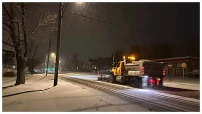
were active across the Midwest on Sunday as a substantial weather system approached the United States, bringing heavy snowfall and disrupting transportation.
American Airlines released a travel advisory affecting 46 airports from Kansas to New Jersey, as the weather system was expected to progress from central United States towards the East Coast, AFP reported.
The National Weather Service activated blizzard alerts in Kansas and Missouri, whilst winter storm and ice storm warnings extended to Washington DC on the East Coast, affecting an unprecedented 1,500-mile (2,400-kilometre) region.
Early Sunday morning brought a combination of freezing rain, sleet and snow to Kansas as the system moved eastward.
The NWS forecast indicated more severe conditions ahead, predicting substantial snowfall accompanied by wind speeds exceeding 40 mph (64 kmh) in the state.
The accumulating storm through Monday would "significantly reduce visibilities, and snowfall amounts will surpass 15 inches" -- the most substantial in ten years -- "which will make travel extremely hazardous, with impassable roads."
The forecast predicted snowfall between 8-14 inches from northeast Missouri through the Central Appalachians.
The Washington region could experience up to 10 inches of snow from Sunday night into Monday, likely causing "significant accumulations, hazardous travel and closings," according to the Washington Post.
Approximately 70 million people across the nation were under various weather alerts, as reported by CNN.
The initial major storm of 2025 had already affected travel, with Kansas City International Airport suspending operations on Saturday "due to rapid ice accumulation."
Operations resumed after treatment of runways and taxiways, as confirmed by Kansas City mayor Quinton Lucas via social media.
The southward-moving jet stream would bring temperatures below zero degrees Fahrenheit (-18 degrees Celsius), with strong winds increasing the risks.
Temperatures could drop significantly below seasonal averages down to the US Gulf Coast, preceded by severe thunderstorms across the lower Mississippi Valley, as per NWS predictions.
Freezing rain and sleet from Kansas to Kentucky and Virginia posed additional risks, potentially causing icy roads, fallen trees, damaged power lines and widespread power outages during cold conditions.
The NWS anticipated extensive tree damage and "long-lasting power outages" from Kansas to the central Appalachian Mountains.
The Appalachian region faced particular vulnerability, having recently experienced a devastating hurricane in late September that affected multiple southeastern states including Kentucky.
Those communities were still recovering from the hurricane's impact.
Governor Andy Beshear addressed an emergency meeting, stating the new storm "will likely cause significant disruption and dangerous conditions on our roads and could cause significant power outages just 24 hours or so before it's going to get really cold in Kentucky."
The governors of Kentucky, Missouri and Virginia declared emergency status and used social media to alert residents about hazardous weekend weather conditions.

 2 days ago
1


 English (US) ·