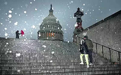
A blast of snow, ice, wind and plunging temperatures stirred up dangerous travel conditions in parts of the US on Sunday, as a disruptive winter storm brought the possibility of the "heaviest snowfall in a decade" to some areas.
Snowfall and ice blanketed major roadways in parts of Kansas and Indiana, where the state's National Guard was activated to help any motorists getting stuck. At least 8 inches of snow were expected, as the National Weather Service issued storm warnings from Kansas and Missouri- where
blizzard conditions
were reported - to New Jersey into Monday. "For locations in this region that receive the highest snow totals, it may be the heaviest snowfall in at least a decade," the weather service said early Sunday. Power outages, downed trees and travel disruptions at airports and on roads are also likely.
About 63 million people in the US were under some kind of
winter weather advisory
, watch or warning on Sunday, according to weather service.
The polar vortex of ultra-cold air usually stays penned up around the North Pole, spinning like a top. But sometimes it escapes or stretches down to the US, Europe or Asia - and that's when large numbers of people experience intense doses of cold. Studies show a fast-warming Arctic gets some of the blame for the increase in polar vortex stretching.
Starting Monday the eastern two-thirds of the country will experience dangerous, bone-chilling cold and wind chills, forecasters said. Temperatures could be 12 to 25 degrees Fahrenheit (7 to 14 degrees Celsius) below normal as the polar vortex stretches down from the high Arctic. In Chicago on Sunday, temperatures hovered in minus 7 to 10 degrees Celsius and around zero F in Minneapolis (minus 18 C), while dropping to 11 F below (minus 24 C) in International Falls, Minnesota, on the Canadian border.
Several states in the path of the weather system - including Arkansas, Kansas, Kentucky, Missouri and Virginia - have declared states of emergency, and Maryland declared a state of preparedness. Parts of upstate New York saw 3 feet or more of snow from a lake effect event expected to last until late Sunday afternoon.
More than 2,000 flights have been delayed and 1,500 cancellled in and out of the US today, BBC reported citing tracking website FlightAware. According to the live data, Kansas City International Airport was the worst affected for outbound flights, with 86% cancelled. For inbound flights, St. Louis Lambert International Airport in Missouri tops the chart, with 53% of flights delayed and 7% cancelled as of 10.20am EST. Amtrak also cancelled numerous trains due to the storm.
By Tuesday, the snow will have ended in the mid-Atlantic, although some light snow may linger over the central Appalachians. Cold, gusty weather is forecast through the week. "It's going to be pretty cold for a good part of the week," NWS' Bob Oravec said.

 1 day ago
2


 English (US) ·