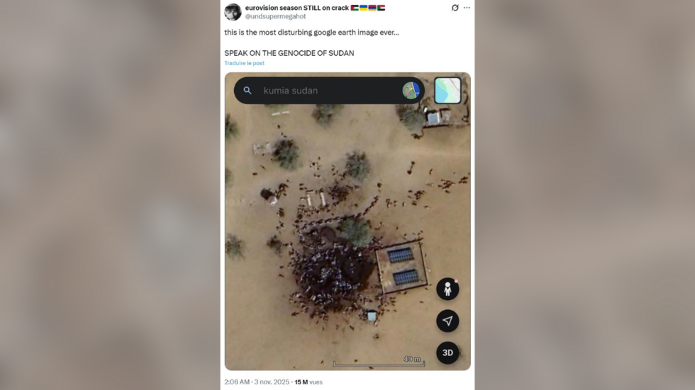
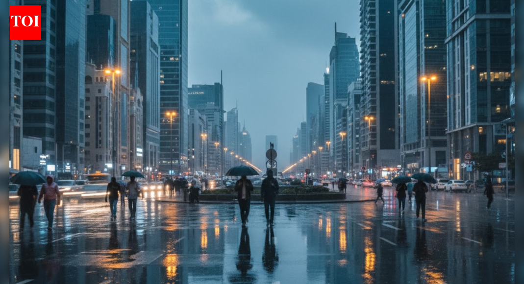
“This is the most disturbing Google Earth image ever…” claimed an anonymous user on X, in a post published on November 3, denouncing the ongoing war in Sudan between the Sudanese army and the paramilitary Rapid Support Forces (RSF).
Viewed more than 15 million times on the platform, the image is a screenshot from Google Earth showing the town of Kumia in southern Sudan. It shows a large dark patch, on which dozens of bodies are reportedly located.
“SPEAK ON THE GENOCIDE IN SUDAN,” the internet user wrote alongside the image.
Read moreSudan: What photos and videos can tell us about the El-Fasher massacres
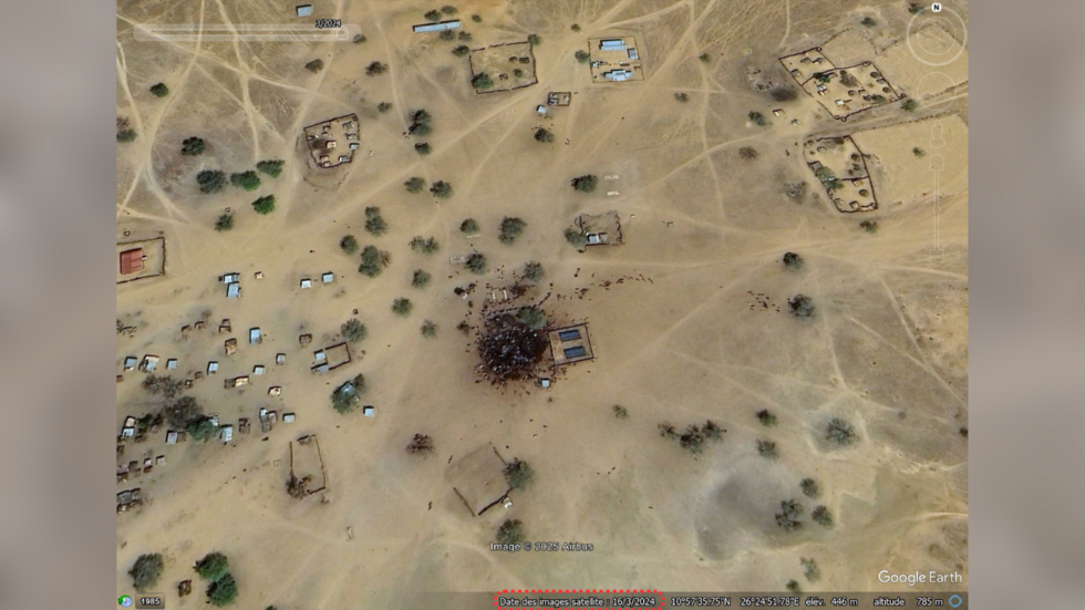
A 2024 Google Earth image showing animals
After El-Fasher was taken by the RSF on October 26, organisations and observers condemned the numerous abuses committed by the paramilitary troops against civilians. On October 30, the UN denounced the “atrocities” committed after the capture of the city, while the International Criminal Court warned that the atrocities “may constitute war crimes and crimes against humanity”.
However, the satellite image that went viral does not show such atrocities. In the hours following the publication of the photo, several satellite imagery analysis specialists, including Benjamin Strick, director of investigations at the Centre for Information Resilience (CIR), denounced a distorted interpretation of these images.
To display this content from X (Twitter), you must enable advertisement tracking and audience measurement.
“I've seen satellite images of what can be indications of war crimes, especially in Sudan, where there is mass destruction, where there might be mass graves or things like that. But this image wasn't any of those, ” he told the FRANCE 24 Observers team.
The image shows Kumia, a town located 300 kilometres south of El-Fasher. It also does not date back to the recent events related to the capture of the city. The information provided by Google Earth indicates that the satellite image was taken on March 16, 2024, more than a year and a half ago.
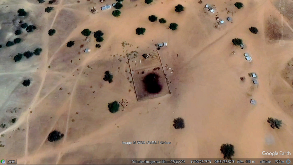
Moreover, the stain, considered by many internet users to be a pool of blood, is not new. Another image of this location from 2022 shows the same stain in the same place.

To display this content from , you must enable advertisement tracking and audience measurement.
Strick said the elements visible in the image actually represent a watering hole surrounded by a herd of cattle, not human bodies:
"When I saw this image, it struck me because of the different colouration in the ground, but also the fact that there were lots of objects on the ground. I've seen these kinds of things before, around cattle and specifically livestock.”
This is confirmed by the fact that similar structures – dark patches surrounded by cattle – can also be seen in the surrounding area, as shown in the image below, taken about ten kilometres away in 2022.
Other satellite images clearly show atrocities committed by the RSF
“Out of all of the things that have come out about Sudan over the past two weeks, this, in my opinion, had almost the most views, ” says Strick. He estimates that this image, which garnered more than 15 million views in a single post on X on November 5, has been viewed “more than any other legitimate verified video”.
“For me, it's a big concern because it means that people can say, ‘maybe the other footage of human rights abuses is fake, maybe the footage of genocide isn't real.’ And it is.”
The use of satellite imagery remains crucial to the analysis of atrocities committed by the RSF in recent days. On October 27, Yale University published satellite images showing evidence of mass killings in the Daraja Oula neighbourhood of El-Fasher.
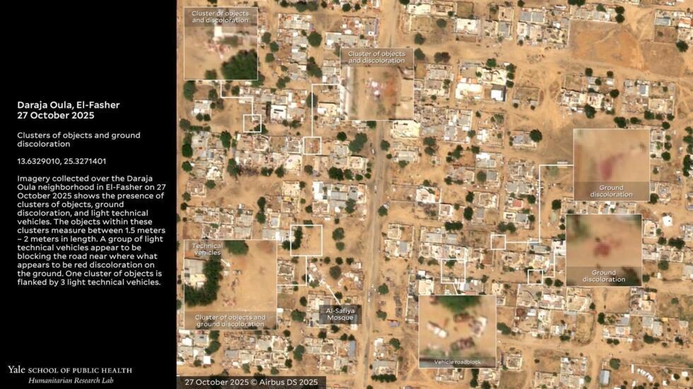
Nathaniel Raymond, a member of Yale’s Humanitarian Research Lab, explained to our team that red discolouration had appeared on the ground “in places where it wasn’t in the days before”. He also said that “this discolouration has appeared near vehicles capable of carrying heavy machine guns. The red discolouration appears systematically next to shapes that are similarly proportioned to human bodies.”
‘We do not draw conclusions solely from satellite images’
“We do not draw conclusions solely from satellite images,” says Strick, who also covered the RSF's abuses in El-Fasher with the CIR, using other satellite images.
He explains the need to recontextualise these images with other factual elements:
"Has there been media reporting from local journalists or sources on the ground that have identified that an abuse had indeed taken place and that the satellite images had captured it? Has there been footage to cross-reference that? It's also important to think about what is indicative in satellite imagery. What can we tell? Often, we can't really determine a genocide from satellite imagery alone. We really need to take a heap of factors into account.”
This article has been translated from the original in French.


 English (US) ·